
Rollerski and Inline Skate on the Michigan Trailway System
Sat, Oct 26, 2002 - By Mike Muha
The 1993 Michigan Trailways legislation calls for a statewide systems of land corridors passing through Michigan's communities & countryside, featuring broad, smooth-surfaced trails for multiple use activities. This link goes to a 1.21MB PDF brochure that describes the Michigan Trailway System (and what you can do to help), plus has a detailed map showing the location of the trailways and whether they're paved (rollerskiable!) or not.
The map is on page 2 of the PDF. There are some errors: For example, the Kal-Haven Trail is marked as "paved" although (as far as I know) it has a crushed gravel surface.
Facts & Figures:
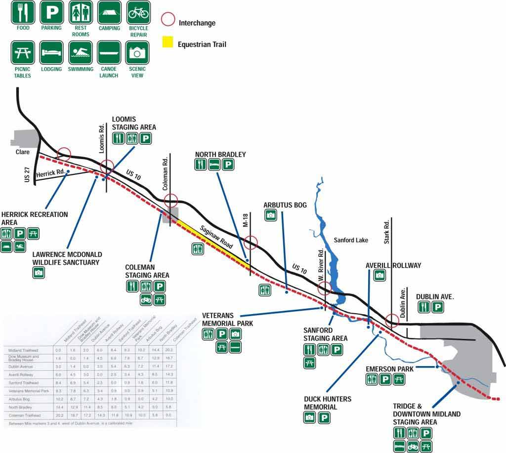
The Pere Marquette Rail Trail
-
Length: 30 miles.
-
Road or bike path? Paved bike path.
-
Need Speed Reducers? No.
-
Big climbs? No, only minor elevation changes over long distances.
-
Rough Pavement? None - nice and smooth. There are a couple dirt road crossings, and you can catch yourself on the lip leading ot a bridge or two.
-
Shorter, easier variations: Yes! Park anywhere, ski as far as you want, turn around, and come back.
-
Trail map (60K)
-
Pictures of the Sanford to Coleman section