
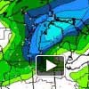
Low pressure developing over the Mid-Mississippi Valley, is forecast to track northeast over the Thumb and Lake Huron tonight, strengthening rapidly as it approaches.
This system will bring plenty of moisture, interacting with cooler air over the Northern Great Lakes to produce heavy snow. Snow and rain will arrive in Central Lower Michigan this afternoon, expanding rapidly northward and turning to all snow this evening. Many areas will see 8 to 12 inches of snow by Saturday morning. East winds will increase and turn gusty late this afternoon, and gradually turn to the northwest tonight. Blowing and drifting snow will be considerable. Near blizzard conditions are expected in exposed areas. Snow and wind will continue into Saturday, though snowfall intensities will decrease. Those with travel plans had best complete them early today; traveling tonight or early Saturday is probably not a wise idea.
After the low pressure passes us, lake effect snow will expected for Saturday night into Sunday with some very chilly temperatures.